 GeoGuess
Look at where the sun sits around midday and which way the satellite dishes face. Outside the tropics the midday sun is always in the southern half of the sky in the northern hemisphere and always in the northern half in the southern hemisphere, and TV dishes face the same way as that midday sun, because the satellites they aim at hang over the equator. Seasons that do not match the calendar (Christmas in summer, snow in July) and southern stars such as the Southern Cross are useful backup clues. Be honest with yourself, though: many photos carry no reliable hemisphere signal at all, and the tropics blur every one of these rules.
The hemisphere matters because it halves the map in one step. If you can tell that a temperate photo is southern, you have ruled out all of Europe, almost all of Asia and all of North America, and you are left with the southern part of South America, Southern Africa, Australia and New Zealand.
Clues at a glance
| Clue | What to look for | How reliable |
|---|---|---|
| Midday sun | Which half of the sky the high sun is in | Strong outside the tropics, but you need to know which way the camera faces |
| Shadows | Short shadows near noon and their direction | Same as the sun; useless without a compass reference |
| Satellite dishes | Which way the dishes on a building face, and how steeply | Strong, and they double as a compass |
| Season against date | Christmas in summer heat, snow or bare trees in July | Strong when the photo shows a date or a festival |
| Southern Cross | The four-star cross next to a dark cloud in the Milky Way | Good in the south; also visible low in the sky from the northern tropics |
| Polaris | A lone star that stays put while the sky turns around it | Only visible from the northern hemisphere |
| The Moon | Which side of the disc is lit | Weak, because you rarely know the phase |
| Water down a drain | Clockwise or anticlockwise swirl | Worthless; a myth |
The midday sun
The rule is simple once you see where it comes from. The sun is only ever directly overhead somewhere between the Tropic of Cancer, at about 23.4 degrees north, and the Tropic of Capricorn, at about 23.4 degrees south. Anywhere north of the Tropic of Cancer, the midday sun is always somewhere to the south. Anywhere south of the Tropic of Capricorn, the midday sun is always to the north.
That covers most of the places people take photos. Every country in Europe, almost all of the United States and Canada, Japan, Korea and most of China lie north of the Tropic of Cancer. New Zealand, Uruguay, most of Argentina and Chile, most of South Africa and all of Australia south of a line running just north of Alice Springs and close to Rockhampton lie south of the Tropic of Capricorn.
Sunrise and sunset do not help in the same way. At the equinoxes the sun rises due east and sets due west everywhere, and in both hemispheres it rises in the east and sets in the west all year. The hemisphere only shows in which way the sun's arc leans: towards the south in the north, towards the north in the south. A low sun near the horizon tells you morning or evening, not hemisphere.
The tropics caveat
Between the two tropics the rule breaks. The sun crosses overhead twice a year, and for part of the year it passes on the north side and for part of the year on the south side. In Singapore, barely north of the equator, the midday sun is in the northern sky for roughly half the year and in the southern sky for the other half. The same applies across Central America, most of the Caribbean, Hawaii, northern Australia, most of Brazil and Africa, India's south and almost all of Southeast Asia.
So if the photo looks tropical (palms, heavy green growth, red laterite soil, monsoon drains), do not trust the sun direction at all. Use the rest of the photo instead: language, traffic side and plates will do far more for you there.
Shadows, and why you need a compass
Shadows point away from the sun. Near midday in the north temperate zone they point roughly north; in the south temperate zone, roughly south. Short shadows are the ones you want, because a short shadow means the sun is high and therefore close to its midday position.
The catch is that a photo does not come with a compass. A shadow pointing "to the left of the frame" means nothing until you know which way the camera faces. You can sometimes recover that:
- Satellite dishes in the frame, covered in the next section, are the best compass you will find in an ordinary street photo.
- A landmark or street you recognise fixes the orientation of everything around it.
- A coastline you can place, for example the sun setting over the sea on a coast you know faces west.
Even then, be careful with long shadows. In the morning the sun is in the east and shadows point west in both hemispheres; in the evening they point east. A long shadow mostly tells you the time of day. Only the slight tilt of that shadow towards north or south carries a hemisphere signal, and that is too subtle to read from most photos.
Satellite dishes point towards the equator
This is the best hemisphere clue in an urban photo, and it works on cloudy days too. Satellite television comes from geostationary satellites, which all sit in one ring directly above the equator, roughly 36,000 km up. A fixed dish has to aim at one of them, so it aims towards the equator:
- In the northern hemisphere dishes face south, often well to the south-east or south-west depending on the longitude of the satellite they use.
- In the southern hemisphere dishes face north.
- Close to the equator dishes point steeply upwards, sometimes almost straight at the sky, when the satellite is at a similar longitude.
- Far from the equator they aim low, closer to the horizon.
Dishes give you a compass. If every dish on a block of flats faces the camera, and you are in the north, the camera is facing roughly north. Now the shadows mean something. The angle also gives you a rough latitude. A dish pointing high suggests you are fairly near the equator; one aimed low suggests you are far from it.
One caution on reading the angle: most small home dishes are offset designs, where the beam leaves at an angle above the line straight out of the dish face. With the face standing vertical, an offset dish is already aiming upwards, commonly by somewhere between about 11 and 30 degrees depending on the design. So small dishes always point higher than they look. Use the angle for broad strokes (steep or shallow), not for a number.
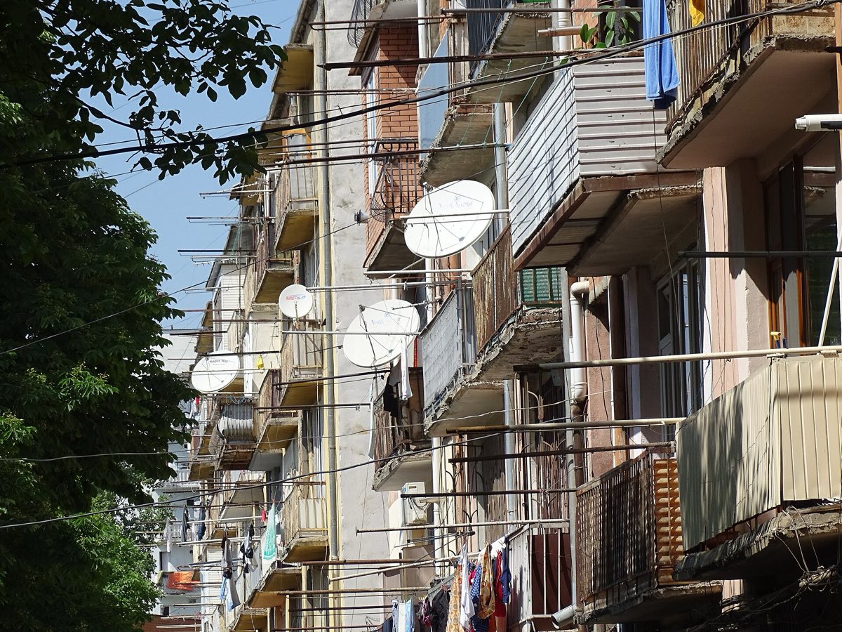
When dishes on one building face slightly different ways, the owners are pointing at different satellites, but they will all be on the equator side of the sky.
Seasons that do not match the date
The two hemispheres always have opposite seasons. December, January and February are summer in the south and winter in the north. That turns any date in a photo into a hemisphere test:
- Christmas decorations in summer heat. Trees, tinsel and Santa figures beside palms, shorts, sunny beaches and long evenings point south. In Australia Christmas falls in summer, and outdoor lunches, cold seafood and swimming are part of the day.
- Snow, skiing or bare trees in July. In the north July is high summer. A ski lift running in July means the southern hemisphere, or a glacier at very high altitude. Australia's ski fields, for example, run from about mid June to early October.
- Autumn colours in April or May, or spring blossom in October, belong to the south.
- School holidays, festival banners and event posters often carry dates. A poster for a winter festival dated August is a southern poster.

The limit is obvious: most photos carry no date. The tropics muddy things too, because many tropical places have wet and dry seasons instead of a summer and a winter. Bare trees in a tropical dry season are not winter in the temperate sense.
The night sky
Night photos are rare, but a clear sky can settle the question.
The Southern Cross
Crux, the Southern Cross, is the small, bright four-star cross that sits right in the Milky Way, next to the Coalsack, a dark patch of dust that looks like a hole in the band of stars. A line drawn along the long axis of the cross, from the top star, Gacrux, to the bottom one, Acrux, and carried on about four and a half times its length, lands close to the south celestial pole. South of about 34 degrees south, which covers Cape Town, Adelaide and Buenos Aires, it never sets.
It is not perfect proof. The Southern Cross can be seen from as far north as about 20 to 25 degrees north, low over the southern horizon for a few hours a night in the northern late winter and spring. High in the sky, though, it is a southern sky.
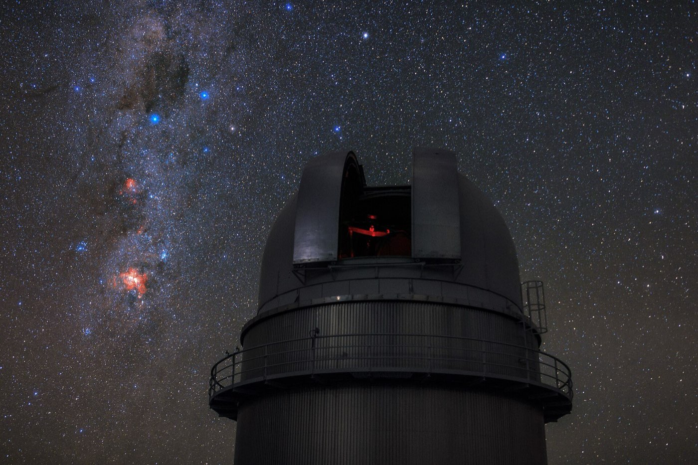
The Southern Cross also appears on the flags of Australia, Brazil, New Zealand, Papua New Guinea and Samoa.
There is no southern pole star to match Polaris. The star closest to the south celestial pole, Sigma Octantis, is barely visible to the naked eye and will not show up in an ordinary photo.
Polaris
Polaris lies less than a degree from the north celestial pole, so on a long-exposure photo every other star draws a circle around it while it barely moves. Its height above the horizon roughly equals your latitude. At the equator it sits on the horizon, and south of the equator it is effectively out of sight. So if star trails circle a visible star high above the horizon, the photo is northern; if they circle an empty patch of sky, you are looking at the southern pole. It is not especially bright, only about the 47th brightest star, so do not look for the brightest point.
The Moon
Seen from the south, the Moon appears rotated by 180 degrees compared with the view from the north, so the lit side swaps. Near the equator, a crescent can lie on its back like a bowl. In practice this rarely helps, because a single photo does not tell you whether the Moon is waxing or waning, and without that the lit side tells you nothing.
The draining water myth
You may have heard that water drains clockwise in one hemisphere and anticlockwise in the other. It does not, at least not in any sink, bath or toilet. The Coriolis effect, which does make large weather systems spin in opposite directions in the two hemispheres, is far too weak at the scale of a basin. The shape of the bowl, the way the water was poured and any leftover swirl are many times stronger.
Careful laboratory experiments have shown the effect, but only in a large tank left perfectly still for a day or more before the plug was pulled. Nothing like that happens in a bathroom.
The tourist demonstrations at the equator in Ecuador, where a guide shows water swirling one way a few steps north of a painted line and the other way a few steps south, are showmanship: at that scale the Coriolis force has no effect, so the swirl comes from the basin and the pouring, not the planet. The marked line at the Mitad del Mundo monument is not even on the true equator, which runs about 240 metres to the north. Ignore any swirl you see in a photo.
Countries on the equator
When you find yourself in the tropics with conflicting clues, it helps to know which countries actually sit on both sides of the line. The equator crosses the land of eleven countries, and the territorial waters of a few more.
| Country | Region | Notes |
|---|---|---|
| São Tomé and Príncipe | Africa | The line crosses the islet of Ilhéu das Rolas |
| Gabon | Africa | |
| Republic of the Congo | Africa | |
| Democratic Republic of the Congo | Africa | |
| Uganda | Africa | Also crosses Lake Victoria and some of Uganda's islands in it |
| Kenya | Africa | Passes just north of Kisumu and through Mount Kenya |
| Somalia | Africa | |
| Indonesia | Asia | Crosses Sumatra, Borneo (through Pontianak), Sulawesi and Halmahera |
| Ecuador | South America | Named after it; also crosses Isabela Island in the Galápagos |
| Colombia | South America | |
| Brazil | South America | |
| Maldives | Asia | Waters only, passing between atolls |
| Kiribati | Oceania | Waters only, passing between atolls |
For these countries the hemisphere question is close to meaningless. A photo from Nairobi and one from northern Kenya are on opposite sides of the line and look much the same. Here the midday sun is close to overhead, dishes point nearly straight up, and the seasons follow the rains rather than the calendar. Treat "near the equator" as the answer and move on to other clues.
Quick checklist
- Is it tropical? If yes, stop trying to read the hemisphere from the sun and use writing, traffic side and plates instead.
- Find a compass. Satellite dishes first, then a landmark or a coastline you can place.
- Check the high sun or short shadows. Sun in the south (shadows north) means north; sun in the north (shadows south) means south.
- Check dish angle. Steep means near the equator, shallow means far from it.
- Look for a date. Christmas in summer, snow in July, autumn leaves in April.
- On a night shot, look for the Southern Cross high up, or star trails around Polaris.
- Ignore drains. Swirling water tells you nothing.
- Accept a blank. If none of these show up, do not force an answer. Most photos have no hemisphere signal, and a confident wrong guess costs more than a neutral one.
For the full method of combining clues, see the pillar guide on guessing a country from a photo, and for the strongest clue that often decides the tropical cases, the guide to countries that drive on the left.
Practice
The hemisphere is something to check on every photo, even if you only get a signal on a few. Play a free round as a guest at /try, no account needed, and ask yourself one question before anything else: which way are the dishes facing? Each country page also has its own round, so you can drill a southern country such as New Zealand or Chile until a sun in the north starts to feel normal.