 GeoGuess
Read the photo in a fixed order and stop as soon as two independent clues agree: any writing first, then which side of the road traffic keeps to, then licence plates and road signs, then the land itself. Most photos are solved by two ordinary clues pointing the same way, not by one rare detail that only a specialist would notice.
The order matters because each step is cheaper than the next. Writing can cut the world down to three countries in a glance. Vegetation almost never can.
Cheat sheet
| Clue type | What to look for | What it tells you |
|---|---|---|
| Script | Cyrillic, Greek, Arabic, Thai, hangul, kana, Ge'ez | A region, sometimes one country |
| Latin letters | ñ, ã, ș, ł, ő, ø, þ, ğ, stacked tone marks | A language, so a short list |
| Traffic side | Which side the cars keep to | About 75 countries and territories drive on the left |
| Licence plate | Shape, colour, band position | Continent, then often the country |
| Road signs | Warning sign shape, line colours, km/h or mph | Sign family, then the country |
| Landscape | Tree types, soil colour, terrain, snow | Climate band and latitude |
| Buildings | Roof material and pitch, shutters, balconies | Region and rough wealth level |
| Poles and wires | Wood, concrete or steel, overhead density | Narrows within a region |
| Shadows | Shadow direction near midday | Hemisphere |
1. Text and script in the photo
Scan for writing before anything else: shop fascias, van liveries, bus destination boards, posters, parking signs and the small print on bins and manhole covers. A photo with no obvious sign often still has a sticker or a number plate somewhere.
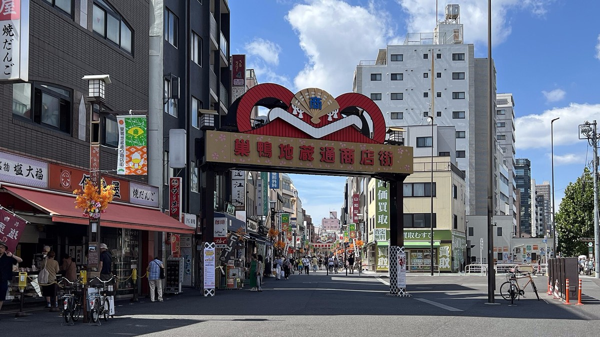
The script alone can finish the job. The Greek alphabet is the official script of only Greece and Cyprus. The Ge'ez script points at Ethiopia or Eritrea. Thai, Lao, Khmer, Burmese, Georgian, Armenian and Hebrew each effectively belong to one country. Hangul means Korea, and Japanese text mixes kana with Chinese characters, so small rounded kana in a block of text means Japan rather than China or Taiwan.
Chinese characters without kana need one more step. Traditional characters are official in Taiwan, Hong Kong and Macau, while the mainland and Singapore use simplified forms. Treat that as a strong hint, not proof, because both forms turn up in logos and calligraphy on either side.
Cyrillic covers Russia, Ukraine, Belarus, Bulgaria, Serbia, North Macedonia and several countries in Central Asia. Inside Cyrillic, і, ї, є and ґ are Ukrainian and absent from Russian, while ы, э and ъ are Russian and not modern Ukrainian.
For a fuller walkthrough, see how to tell scripts apart.
2. Language clues inside the Latin alphabet
Latin text is not the end of the trail. Accented letters are the quickest way in, because most are tied to one language.
- ñ is Spanish. ã and õ are Portuguese.
- ș and ț with commas underneath are Romanian.
- ł, ż, ę and ą are Polish. ě, ř and ů are Czech.
- ő and ű carry a double acute, which is a reliable Hungarian marker.
- å, ä and ö point at Sweden or Finland. æ, ø and å point at Denmark or Norway.
- þ (thorn) is Iceland. Its neighbour ð (eth) is also used in Faroese, so eth without thorn suggests the Faroe Islands.
- ı (dotless i), ğ and ş mean Turkey. Add ə and you are in Azerbaijan instead.
- Two diacritics stacked on one vowel, as in ế or ữ, plus the letter đ, mean Vietnam.
- ß is German, which still leaves Germany, Austria and parts of Switzerland.
Where a language spans several countries, brand names help: post offices, banks, supermarket chains and telecom operators are national. A fuller breakdown lives in Latin alphabet letters by language.
3. Which side of the road traffic is on
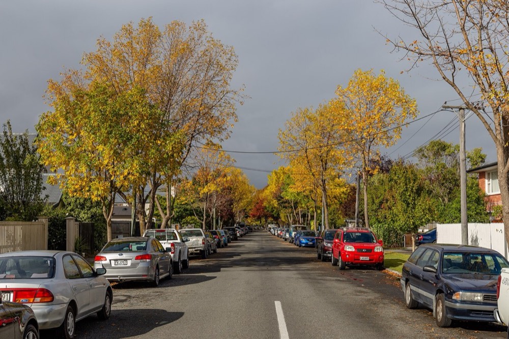
This clue is free and it splits the map cleanly. Around 75 countries and territories drive on the left, holding about a third of the world's population, so it is a real split rather than a rare exception.
Four ways to read it from a still photo:
- Moving cars. The lane a vehicle takes on a two-way road settles it.
- Parked cars. A weak cue: kerbside parking usually faces the direction of travel, but plenty of drivers ignore that.
- The driver's seat. A steering wheel on the right means left-hand traffic.
- Roundabouts. Traffic circulates clockwise in left-hand-traffic countries, anticlockwise elsewhere.
Memorise the list in blocks. In Europe it is only the United Kingdom, Ireland, Cyprus and Malta, all islands. In Asia it includes Japan, India, Pakistan, Bangladesh, Nepal, Sri Lanka, Thailand, Indonesia, Malaysia, Singapore, Hong Kong and Macau. In Africa it runs down the east and south, from Kenya to South Africa. In the Americas it is Suriname, Guyana and most of the Caribbean. In Oceania it is Australia, New Zealand and much of the Pacific. The full list is in countries that drive on the left.
4. Licence plates
You rarely need to read the characters. Shape, background colour and band position are enough.
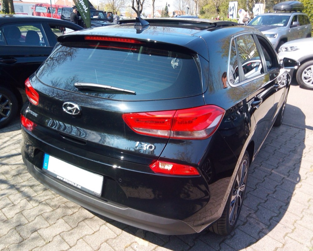
European Union. A long thin plate, usually 520 mm by about 110 mm, with a blue band down the left carrying twelve yellow stars and a country code: D for Germany, F for France, E for Spain, I for Italy, PL for Poland. Most are white, but the Netherlands and Luxembourg use yellow front and rear, and the United Kingdom pairs a white front plate with a yellow rear one.
Blue band, no stars. Norway puts its flag in the band beside the code N. Serbia, Bosnia and Herzegovina and Montenegro use a plain blue band with just the code. UK plates issued since 2021 that have a band carry the letters UK, not the EU stars.
National twists. Belgian plates use dark ruby red characters on white. Austrian plates carry red and white bands along the top and bottom edges. Irish plates put the county name in Irish above the number. Russian plates put the code RUS, the flag and the region number on the right rather than the left.
North America. Shorter and squarer, 150 mm by 300 mm, with the state or province name on the plate and a huge variety of colours and background artwork.
South America. The Mercosur plate is white, 400 mm by 130 mm, with a blue band across the top carrying the country name, its flag and the Mercosur logo. Uruguay adopted it in 2015, Argentina in 2016, Brazil in 2018 and Paraguay in 2019. Chile differs: black on white with CHILE along the bottom.
5. Road signs and road markings
Signs are built to be read at a distance, so they survive a low-resolution photo.
Warning sign shape splits the world into two families. Most of Europe, and most Vienna Convention countries, use an upward triangle with a red border. North America uses a yellow diamond, and so do Japan, Australia, New Zealand and Ireland, which makes Ireland stand out from its neighbour.
Warning sign background separates countries inside Europe. Sweden, Finland, Iceland and Poland use a yellow background inside the red triangle. Norway uses white for permanent warnings and yellow only for temporary ones.
Centre line colour is the strongest single clue on an empty road. Yellow lines separate opposing traffic in the United States, Canada, Mexico, Brazil and much of the rest of the Americas, and in Norway. Most of Europe, Australia and New Zealand use white.
Stop signs are a red octagon in the large majority of countries. Japan is the well-known exception: a solid red downward-pointing triangle reading 止まれ, with STOP added in English since 2017.
Units and colours. Speed limits are in km/h nearly everywhere, with the United States, the United Kingdom and a few Caribbean states posting mph. Direction sign colours are national and not shared: Italy uses green for motorways and blue for ordinary roads, France does the opposite.
Traffic lights. Vertical mounting is the international norm. Horizontal three-light heads are usual in Japan and turn up in parts of North America.
6. Landscape, vegetation and climate
Landscape rarely names a country on its own, but it sets a band of latitude and rules out most of the map.
Work through terrain, then vegetation, then soil. Conifer and birch forest on thin soil says boreal: Canada, the Nordic countries or Russia. Dry scrub with olive and cypress says Mediterranean. Deep red or orange soil suggests tropical laterite or the Australian interior. Dense broadleaf jungle with banana and palm says equatorial.
Be careful with famous plants, because forestry has moved most of them. Eucalyptus is native to Australia but is now among the world's most widely planted plantation trees, so a stand of it is just as likely in Portugal, Spain, Brazil, South Africa or California. A few species stay honest: the saguaro cactus grows wild only in the Sonoran Desert, meaning southern Arizona and the Mexican state of Sonora.
Snow, leaf colour and crop stage give you the season, which you need for the next step.
7. Architecture and street furniture
Buildings answer "which part of the region" once the earlier clues have chosen one.
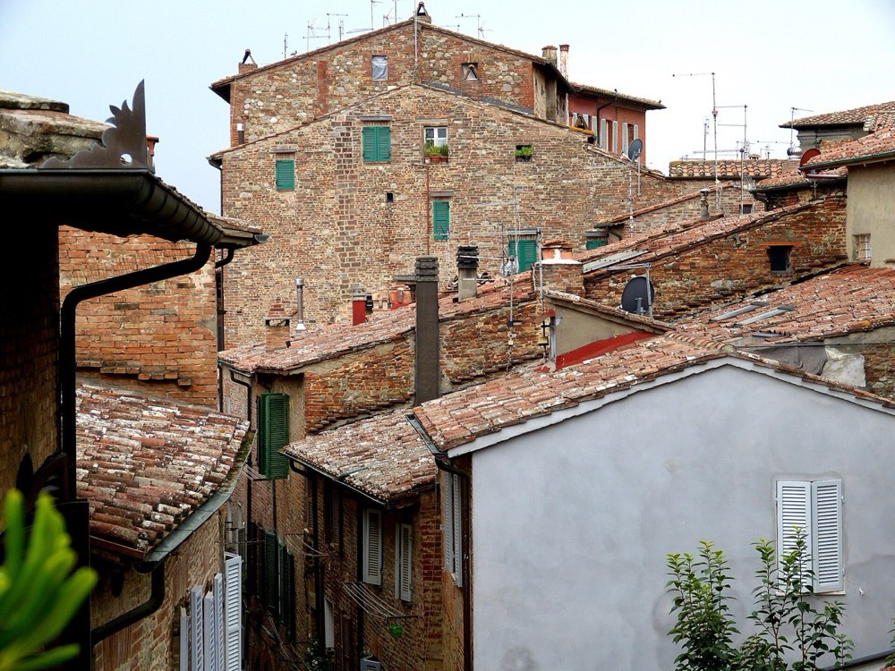
Roofs. Low-pitched terracotta barrel tiles are Mediterranean and Latin American. Steep pitches with deep eaves suggest heavy snow. Corrugated galvanised iron is everywhere but in different roles: normal rural roofing in Australia, New Zealand and the rural United States, and the standard material of informal settlements across much of Africa.
Poles and wires. Wooden poles dominate in North America and rural Britain. Concrete poles are usual in Japan and across much of southern Europe, Latin America and Asia. Japan also keeps unusually large amounts of distribution wiring overhead, so a narrow street roofed by a tangle of cables is a strong Japan signal. One pole is nearly a pin on its own: the Stobie pole, two steel I-beams with a concrete slab clamped between them, is used widely only in South Australia.
Everything at eye level. Bollards, kerb stones, bin designs, post boxes and pedestrian barriers are standardised nationally and rarely change. Collect them for the countries you play most: they survive in photos where nothing else is readable.
8. Sun position and shadows for hemisphere
Shadows give you the hemisphere when nothing else will.
North of the Tropic of Cancer, at about 23.4 degrees north, the midday sun is always somewhere in the southern sky, so shadows near noon point north. South of the Tropic of Capricorn the reverse holds: the midday sun sits in the northern sky and noon shadows point south. Between the tropics the noon sun swaps sides with the season, so shadows tell you very little there.
You need short shadows for this. A long shadow is a morning or evening shadow whatever the latitude, and those point much the same way in both hemispheres. Combine the shadow with the season you read from the vegetation: full summer foliage with shadows pointing south puts you in the southern hemisphere, ruling out most of Europe and North America.
Common mix-ups
| Pair | The one detail that separates them |
|---|---|
| Spain and Argentina | EU blue stripe down the left versus a Mercosur band across the top |
| Portugal and Brazil | Same plate test: Portugal carries the EU stars |
| Sweden and Norway | Sweden's warning triangles are yellow, Norway's are white; Norway paints yellow centre lines |
| United Kingdom and Ireland | Ireland uses yellow diamond warnings and km/h, the UK uses red triangles and mph |
| Netherlands and Belgium | Dutch plates are yellow, Belgian plates are dark red on white |
| Germany and Austria | Austrian plates have red and white bands top and bottom |
| Australia and New Zealand | Australian plates print the state name and a slogan, NZ plates are plain black on white |
| Russia and Ukraine | Ukrainian text uses і, ї and є; Ukrainian plates band on the left, Russian code on the right |
| Japan and South Korea | Kana versus hangul; Japan drives on the left, Korea on the right |
Putting it together: a worked checklist
Run this in order and stop early when two clues agree.
- Any writing? Identify the script.
- If it is Latin, hunt for accented letters and brand names.
- Which side of the road are the cars on?
- Plate shape, background colour, band position.
- Warning sign shape and background, centre line colour, km/h or mph.
- Terrain, dominant trees, soil colour, season.
- Roof material and pitch, pole material, overhead wire density.
- Shadow direction, if the shadows are short.
- Name your two best clues. If they disagree, trust the man-made one, because plants and weather travel and infrastructure does not.
That last step separates a good guess from a lucky one. A single clue can be wrong: plants are planted, cars are imported, buildings get copied. Two independent clues that agree almost never are.
Practice
Play a free guest round with this checklist beside you and work the steps in order, even when you think you know the answer. Naming the clue out loud makes it stick.
To drill one place at a time, each country page has its own round, for example Japan or Brazil. The countries you keep confusing beat another random round.